
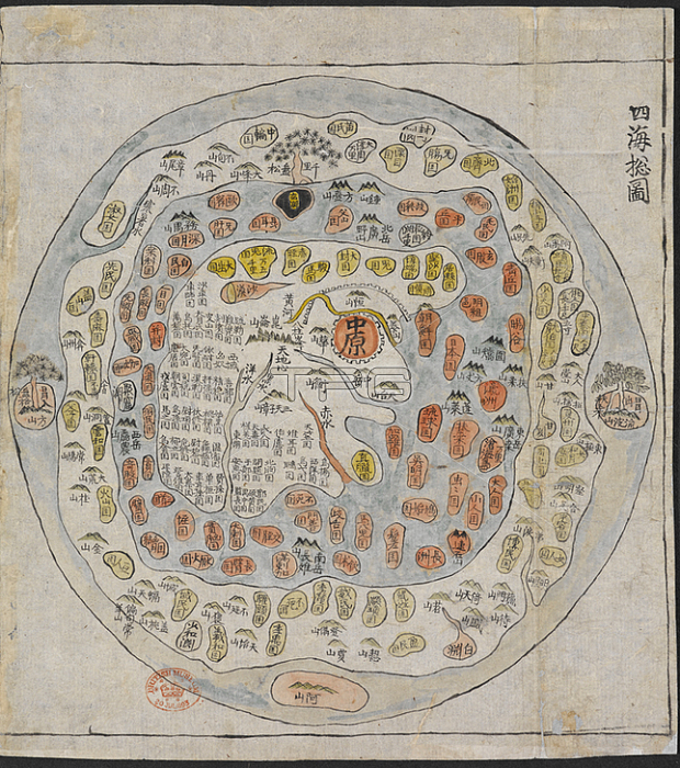
A Korean World Map; A Korean World Map; printed and hand-coloured; from an atlas of Korea with preliminary maps of the world; China; Japan and Ryuku islands.Image taken from Chonhado / World Atlas.Originally published / produced in Korea; 19th Century.Korea; 19th Century.From: Chonhado / World Atlas.Maps. C. 27. f. 14London; British Library.
| px | px | dpi | = | cm | x | cm | = | MB |
Details
Creative#:
TOP21010578
Source:
達志影像
Authorization Type:
RM
Release Information:
須由TPG 完整授權
Model Release:
No
Property Release:
No
Right to Privacy:
No
Same folder images:
Restriction:
Additional permissions needed for non-editorial use.
 Loading