
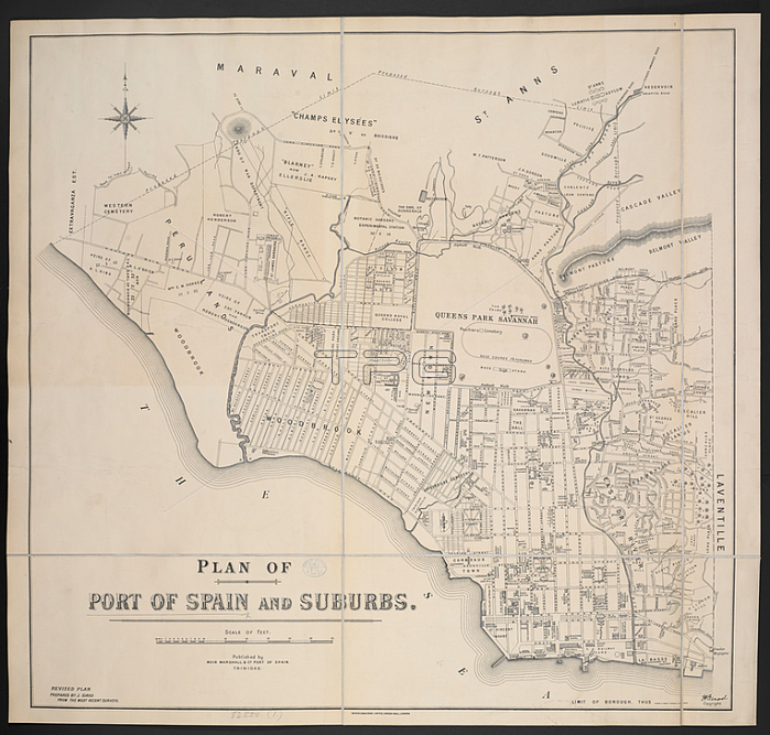
A plan of Port of Spain and suburbs.Port of Spain: Muir; Marshall & Co. 1912.From: Plan of Port of Spain and suburbs. Scale of feet; 40[ = 160 mm.]. Revised plan prepared by J. Girod.Maps 82550. (1.) London; British Library.
| px | px | dpi | = | cm | x | cm | = | MB |
Details
Creative#:
TOP21010548
Source:
達志影像
Authorization Type:
RM
Release Information:
須由TPG 完整授權
Model Release:
No
Property Release:
No
Right to Privacy:
No
Same folder images:
Restriction:
Additional permissions needed for non-editorial use.
 Loading