
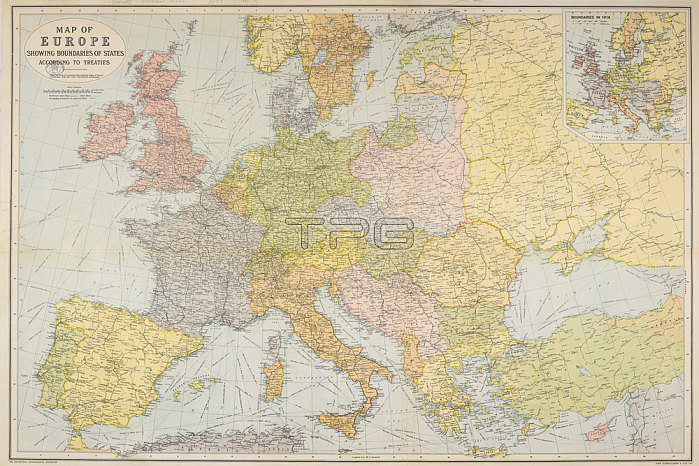
Map of Europe showing boundaries of States according to Treaties. Scale; 1: 5; 500; 000. (Boundaries in 1914). 820 x 955 mm.; Scale 1: 5 500 000.Edinburgh: G. Bartholomew & Son; 1921.From: Map of Europe showing boundaries of States according to Treaties. Scale; 1: 5; 500; 000. (Boundaries in 1914).Maps. 1035. (181)London; British Library.
| px | px | dpi | = | cm | x | cm | = | MB |
Details
Creative#:
TOP21010547
Source:
達志影像
Authorization Type:
RM
Release Information:
須由TPG 完整授權
Model Release:
No
Property Release:
No
Right to Privacy:
No
Same folder images:
Restriction:
Additional permissions needed for non-editorial use.
 Loading