
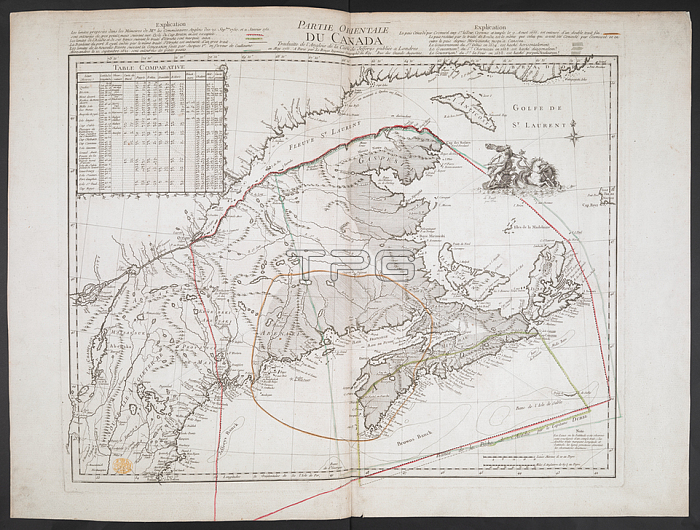
A French copy of an English map; published during the American Revolutionary War; showing the eastern part of Canada. Geographical detail extends from Cape Breton in the east down the Saint Lawrence River as far as Montr閍l; and from the coast of Labrador in the north to Boston in the south. Historical border delineations are clearly marked.Paris: par Le Rouge Ingenieur Geographe du Roy. Rue des Grands Augustins; [1755.].From: PARTIE ORIENTALE DU CANADA: Traduitte de l'Anglois de la carte de Jefferys publi閑 a Londres en May 1755.Maps K. Top. 119.12London; British Library.
| px | px | dpi | = | cm | x | cm | = | MB |
Details
Creative#:
TOP21010456
Source:
達志影像
Authorization Type:
RM
Release Information:
須由TPG 完整授權
Model Release:
No
Property Release:
No
Right to Privacy:
No
Same folder images:
Restriction:
Additional permissions needed for non-editorial use.
 Loading