
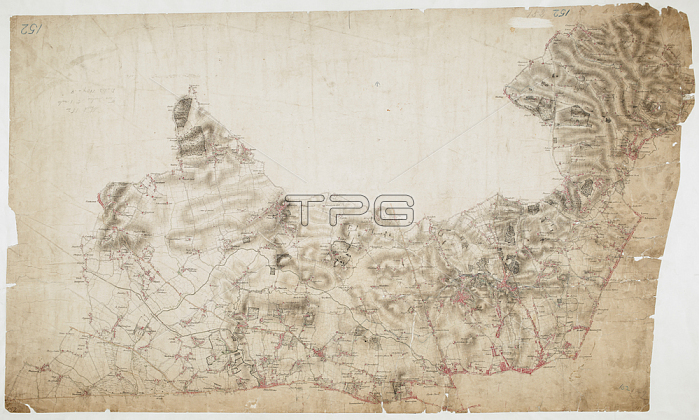
William Hyett.Map of Hampstead.The individual settlements that make up this area of London are shown by red blocks; with boundary lines indicating the fields separating them. Shading and soft interlining indicate relief; neatly illustrated at Primrose Hill; the summit of which is left bare. The barracks at the edge of Hyde Park are illustrated at the very bottom of the map. The dark blue-black line running from West Drayton to Brentford and Paddington is the Grand Junction Canal. This was London's principal link to the rest of Britain's canals; allowing the passage of goods to and from the industrial towns of the North and Midlands. Hyett includes a ground plan of Kenwood House in Hampstead; showing a level of detail much greater than might be expected from a map with a scale of two inches-to-the-mile. Map scale ratio: 2'': 1 Mile (1: 31680).Length: 51; Width: 30Pen and ink on paper.1807.From: [Hampstead.].OSD 152; no. 20London; British Library.
| px | px | dpi | = | cm | x | cm | = | MB |
Details
Creative#:
TOP21010445
Source:
達志影像
Authorization Type:
RM
Release Information:
須由TPG 完整授權
Model Release:
No
Property Release:
No
Right to Privacy:
No
Same folder images:
Restriction:
Additional permissions needed for non-editorial use.
 Loading