
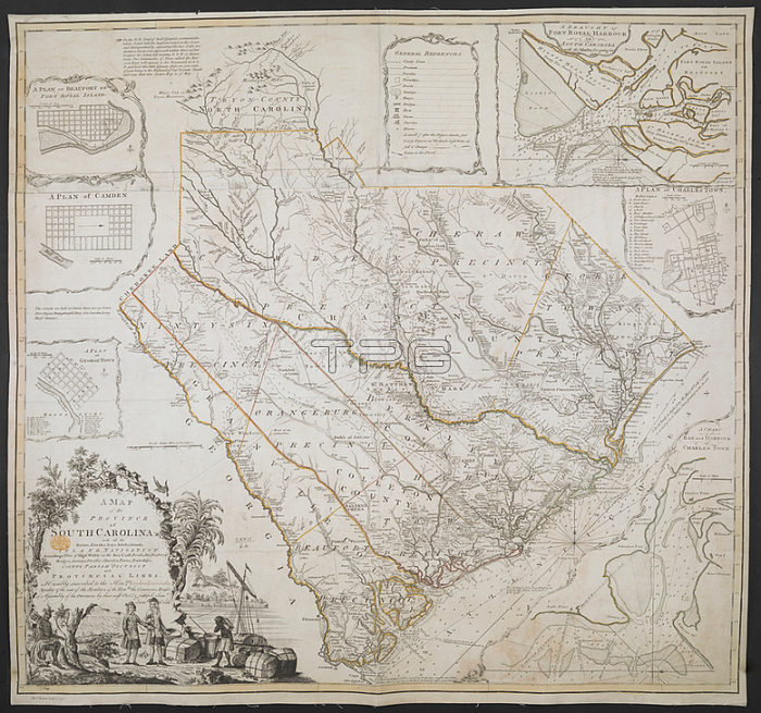
James Cook.A Map of the Province of South Carolina; Joined and laid on linen; copperplate engraving; original hand colour in outline.[London]: Tho. s Bowen Sculp. t; 1773.From: A MAP of the PROVINCE of SOUTH CAROLINA with all the Rivers; Creeks; Bays; Inletts; Islands; INLAND NAVIGATION; Soundings; Time of High Water on the Sea Coast; Roads; Marshes; Ferrys; Bridges; Swamps; Parishes Churches; Towns; Townships; COUNTY PARISH DISTRICT and PROVINCIAL LINES.Maps K. Top. 122.64London; British Library.
| px | px | dpi | = | cm | x | cm | = | MB |
Details
Creative#:
TOP21008859
Source:
達志影像
Authorization Type:
RM
Release Information:
須由TPG 完整授權
Model Release:
No
Property Release:
No
Right to Privacy:
No
Same folder images:
Restriction:
Additional permissions needed for non-editorial use.
 Loading