
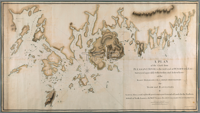
A plan of the coast from Pleasant River to the west end of Penobscott Bay; Joined and laid on linen; manuscript pen and ink with watercolour.[Portsmouth; New Hampshire?]: By Messrs. CHARLES BLASKOWITZ & JAMES GRANT; 1772.From: A PLAN of the Coast from PLEASANT RIVER to the west end of PENOBSCOT BAY / Surveyed agreeably to the Orders and Instructions of the RIGHT HONORABLE the LORDS COMMISSIONERS for TRADE and PLANTATIONS to SAMUEL HOLLAND ESQR. HIS MAJESTY'S Surveyor General of Lands for the Northern District of North America.Maps K. Top. 120.21London; British Library.
| px | px | dpi | = | cm | x | cm | = | MB |
Details
Creative#:
TOP21008783
Source:
達志影像
Authorization Type:
RM
Release Information:
須由TPG 完整授權
Model Release:
No
Property Release:
No
Right to Privacy:
No
Same folder images:
Restriction:
Additional permissions needed for non-editorial use.
 Loading