
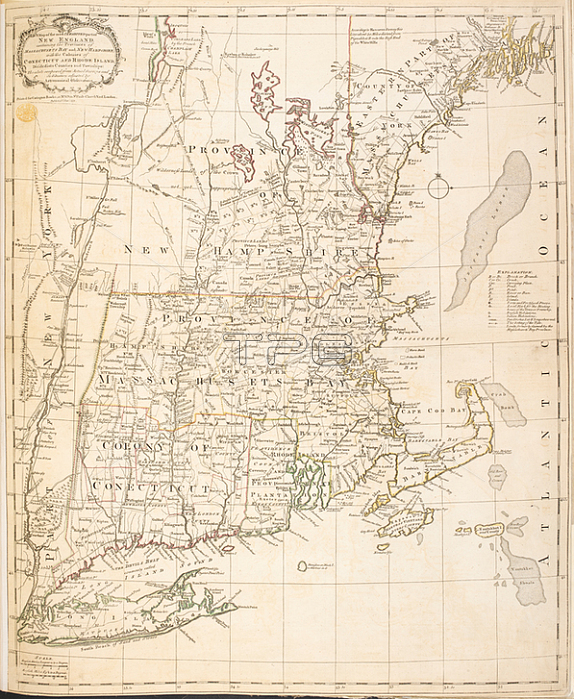
A map of New England.[London]: Printed for Carington Bowles at at No. 69 in St. Pauls ChurchYard London; publish'd 1st Jany. 1771.From: A Map of the most INHABITED parts of NEW ENGLAND; containing the Provinces of MASSACHUSETS BAY and NEW HAMPSHIRE; with the Colonies of CONECTICUT AND RHODE ISLAND; divided into Counties and Townships: The whole composed from Actual Surveys and its Situation adjusted by Astronomical Observations.Maps K. Top. 120.17London; British Library.
| px | px | dpi | = | cm | x | cm | = | MB |
Details
Creative#:
TOP21008781
Source:
達志影像
Authorization Type:
RM
Release Information:
須由TPG 完整授權
Model Release:
No
Property Release:
No
Right to Privacy:
No
Same folder images:
Restriction:
Additional permissions needed for non-editorial use.
 Loading