
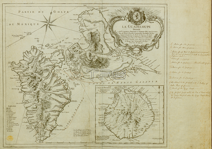
A map of Guadeloupe created in the context of the Seven Year's War; its West Indies Campaign; and the invasion of Guadeloupe in 1759. Includes an inset of Marie Galante Island.Paris: [Georges-Louis Le Rouge]; Rue des Augustins; 1753.From: Le Rouge; LE GUADELOUPE.Maps K. Top. 123.90London; British Library.
| px | px | dpi | = | cm | x | cm | = | MB |
Details
Creative#:
TOP21008539
Source:
達志影像
Authorization Type:
RM
Release Information:
須由TPG 完整授權
Model Release:
No
Property Release:
No
Right to Privacy:
No
Same folder images:
Restriction:
Additional permissions needed for non-editorial use.
 Loading