
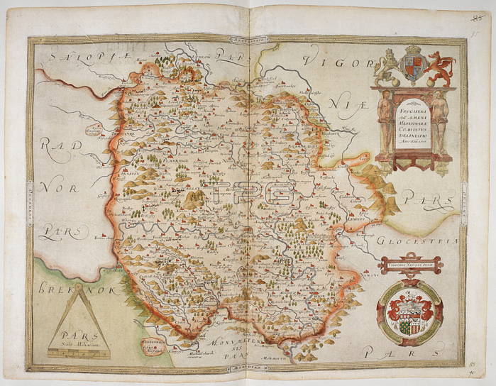
Christopher Saxton.Map of Herefordshire; 1577. SAXTON'S SAXTON.England [London]; 1579.From: Lord Burghley's Atlas. Maps of counties of England and Wales; printed and coloured; from drawings by Christopher Saxton.Royal 18 D. III f. 95London; British Library.
| px | px | dpi | = | cm | x | cm | = | MB |
Details
Creative#:
TOP21007829
Source:
達志影像
Authorization Type:
RM
Release Information:
須由TPG 完整授權
Model Release:
No
Property Release:
No
Right to Privacy:
No
Same folder images:
Restriction:
Additional permissions needed for non-editorial use.
 Loading