
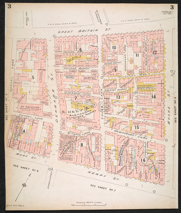
Section of an insurance Plan of the City of Dublin; showing the area between Great Britain street and Mary sreet and Henry street. fol.; Scale; 40 ft. = 1 inch. Key-Plan; 600 ft. = 1 inch.London: C.E. Goad; 1893.From: Insurance Plan of the City of Dublin. [By] C.E. Goad. Scale; 40 ft. = 1 inch. Key-Plan; 600 ft. = 1 inch. Vol. 1.Maps. 145. b. 4. (2) sheet 3London; British Library.
| px | px | dpi | = | cm | x | cm | = | MB |
Details
Creative#:
TOP21005869
Source:
達志影像
Authorization Type:
RM
Release Information:
須由TPG 完整授權
Model Release:
No
Property Release:
No
Right to Privacy:
No
Same folder images:
Restriction:
Additional permissions needed for non-editorial use.
 Loading