
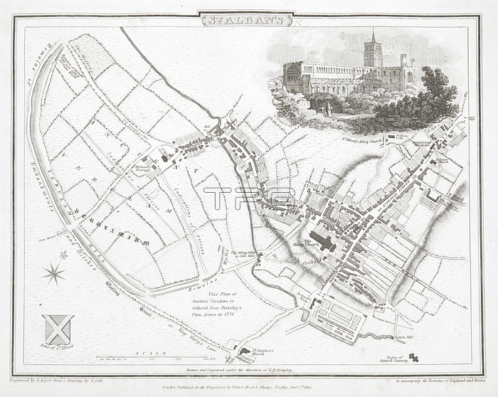
A plan of St. Albans.London: Vernor; Hood; and Sharpe; 1810.From: St. Alban's. Scale; 2; 000 feet[ = 53 mm.]. Engraved by J. Roper from a drawing by G. Cole. 1810.Maps 11. b. 3; page 79London; British Library.
| px | px | dpi | = | cm | x | cm | = | MB |
Details
Creative#:
TOP21005863
Source:
達志影像
Authorization Type:
RM
Release Information:
須由TPG 完整授權
Model Release:
No
Property Release:
No
Right to Privacy:
No
Same folder images:
Restriction:
Additional permissions needed for non-editorial use.
 Loading