
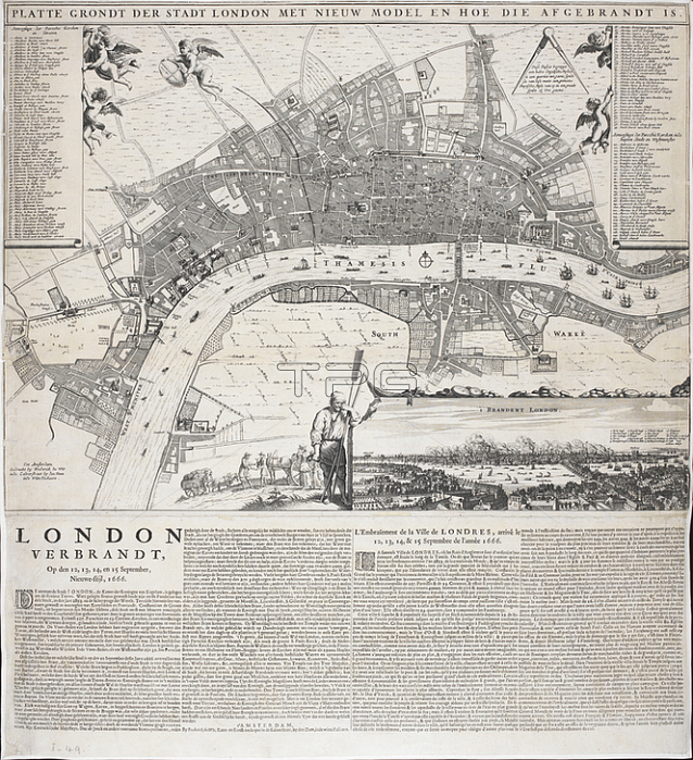
Frederick de Wit.A 17th century Dutch plan of London; showing the River Thames.Amsterdam: by Frederick de Wit; Kaert- en Konst-verkoper in de Kalverstraet; by den Dam; inde witte Pascaert; 1666.From: Frederick de Wit; Platte grondt der stadt London met de aenwysinghe hoe die afgebrandt is gedruckt.Maps. Crace. I. 49London; British Library.
| px | px | dpi | = | cm | x | cm | = | MB |
Details
Creative#:
TOP21000051
Source:
達志影像
Authorization Type:
RM
Release Information:
須由TPG 完整授權
Model Release:
No
Property Release:
No
Right to Privacy:
No
Same folder images:
Restriction:
Additional permissions needed for non-editorial use.
 Loading