
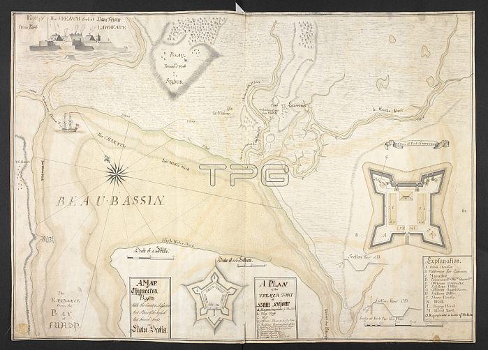
Charles Collins.An English produced manuscript map of the isthmus of Chignectou with inset plans of Fort Beaus閖our (later Fort Cumberland) and Fort Lawrence; and an inset view of of Fort Beaus閖our.[Fort Lawrence?]: Charles Husband Colins; Sept. 1754.From: Charles Collins; A MAP. of Chignectou Bason With the Country Adjacent And Plans of the English And French Forts in Nova Scotia.Maps K. Top. 119.65London; British Library.
| px | px | dpi | = | cm | x | cm | = | MB |
Details
Creative#:
TOP20999176
Source:
達志影像
Authorization Type:
RM
Release Information:
須由TPG 完整授權
Model Release:
No
Property Release:
No
Right to Privacy:
No
Same folder images:
Restriction:
Additional permissions needed for non-editorial use.
 Loading