
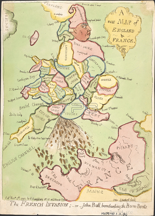
James Gillray.A pictorial map of England with the face of John Bull. A French invasion fleet is pictured in the English channel. A political cartoon.1 map ; 33 x 24cm.London: Pub[lishe]d Nov[embe]r 5th 1793 by H. Humphrey No 18 Old Bond Street; 1793.From: A new Map of England & France. The French Invasion; -or-John Bull; bombarding the Bum-Boats. [James Gillray]. John Schoebert fecit.Maps. 187. l. 3. (3)London; British Library.
| px | px | dpi | = | cm | x | cm | = | MB |
Details
Creative#:
TOP20997055
Source:
達志影像
Authorization Type:
RM
Release Information:
須由TPG 完整授權
Model Release:
No
Property Release:
No
Right to Privacy:
No
Same folder images:
Restriction:
Additional permissions needed for non-editorial use.
 Loading