
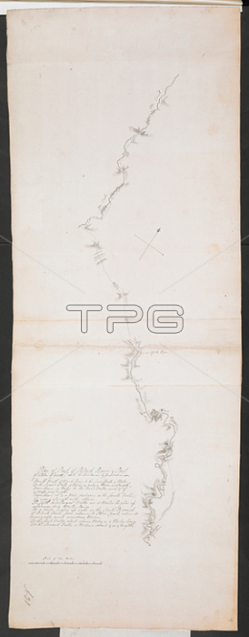
鈥楶lan of part of Black River and part of Otter Creek'; possibly by one 鈥楨nsign Wilson'; mid 18th cent. The map; which shows the two watercourses and a path between them; was intended to accompany the report by Ensign Wilson on an expedition up the Black River; details are given in a contemporary note attached to the map.1: 158400. 鈥楽cale of ten miles' (= 4 inches). 885 x 325mm.Mid 18th century.From: R.U.S.I. MAPS. Vol. LXXVI (1-13). 57711 (1-4). Places in states North-East of New York.Add. 57711.4 Amherst no. A 31. R.U.S.I. no. A 29.42.London; British Library.
| px | px | dpi | = | cm | x | cm | = | MB |
Details
Creative#:
TOP20996777
Source:
達志影像
Authorization Type:
RM
Release Information:
須由TPG 完整授權
Model Release:
No
Property Release:
No
Right to Privacy:
No
Same folder images:
Restriction:
Additional permissions needed for non-editorial use.
 Loading