
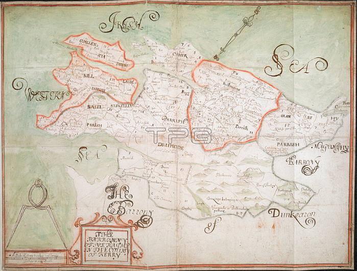
Anonymous.鈥楾he Barronny of Iveragh'; co. Kerry (Munster); by an unidentified surveyor; [1655-1656?]. North west at top. Scale: 320 perches to the inch [1: 63360]. Showing boundaries of parishes (in colour) and townlands; with place-names. Rivers and areas of bog are indicated; and mountains and woodland shown pictorially. Cartouche decorated with scrolled border. Scale bar surmounted by compasses. 42.5 x 55cm.[1655-1656?].From: 鈥楾he Barronny of Iveragh'; co. Kerry (Munster) '. Petty Papers. VOL. XXIV. Loose Down Survey maps; [1655?]-1659.Add. 72873. ELondon; British Library.
| px | px | dpi | = | cm | x | cm | = | MB |
Details
Creative#:
TOP20995220
Source:
達志影像
Authorization Type:
RM
Release Information:
須由TPG 完整授權
Model Release:
No
Property Release:
No
Right to Privacy:
No
Same folder images:
Restriction:
Additional permissions needed for non-editorial use.
 Loading