
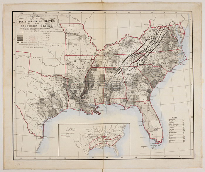
A map showing the distribution of slaves in the Southern States of North America.[New York?]; [1861?].From: Map; showing the Distribution of Slaves in the Southern States. Projected and compiled by A. von Steinwehr.Maps 71495. (51.) London; British Library.
| px | px | dpi | = | cm | x | cm | = | MB |
Details
Creative#:
TOP20994994
Source:
達志影像
Authorization Type:
RM
Release Information:
須由TPG 完整授權
Model Release:
No
Property Release:
No
Right to Privacy:
No
Same folder images:
Restriction:
Additional permissions needed for non-editorial use.
 Loading