
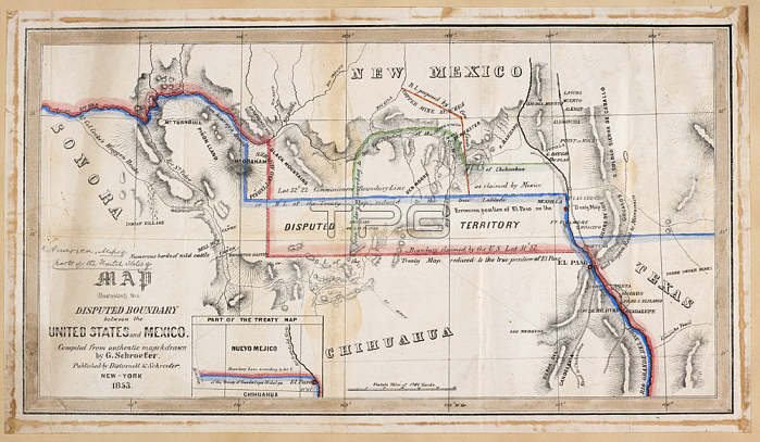
A map illustrating the disputed boundary between the United States and Mexico.New York; 1853.From: Map illustrating the disputed Boundary between the United States and Mexico. Compiled. & drawn by G. Schroeter.Maps 71495. (25.) London; British Library.
| px | px | dpi | = | cm | x | cm | = | MB |
Details
Creative#:
TOP20994980
Source:
達志影像
Authorization Type:
RM
Release Information:
須由TPG 完整授權
Model Release:
No
Property Release:
No
Right to Privacy:
No
Same folder images:
Restriction:
Additional permissions needed for non-editorial use.
 Loading