
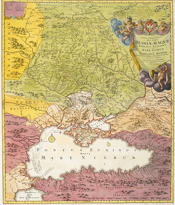
A map dated 1720; drawn between the years of 鈥楾he Great Northern War' (1700-1721); before Peter I created the Russian empire. Indicated on the map in bold lettering are the names: Russiae Minoris (Ukraine); Russiae Maximae (Russia); Poloniae; Podolia; Braslaviensis; Bulgaria; Tartaria Minor; Tartaria Budiacensis; Cremia; Circassia seu regio Circassiorum.1720.From: Tabula Geographica qua pars Russiae. Pontus Euxinus. et Tartaria Minor. exhibentur.Maps. K. top. 112.98London; British Library.
| px | px | dpi | = | cm | x | cm | = | MB |
Details
Creative#:
TOP20994553
Source:
達志影像
Authorization Type:
RM
Release Information:
須由TPG 完整授權
Model Release:
No
Property Release:
No
Right to Privacy:
No
Same folder images:
Restriction:
Additional permissions needed for non-editorial use.
 Loading