
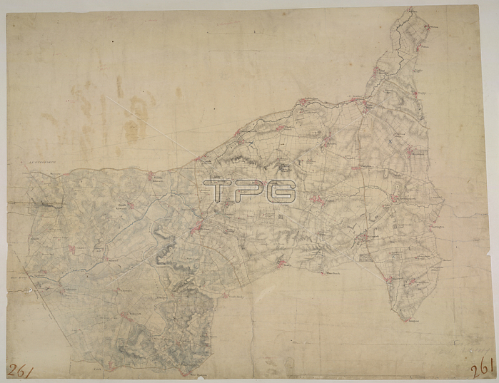
H Stevens.Welford. This drawing depicts the boundary of Leicestershire and Northamptonshire. The county border is indicated at top left by a pecked line following the course of the River Avon. Relative relief is depicted by brushwork interlining (鈥榟achuring') and ink wash. A section of the Watling Street is shown at bottom left. This Roman road ran from London to Wroxeter in Wales; via St. Albans and Leicester (where it intersected the Fosse Way; the Roman road from Exeter to Lincoln). Triangulation points and pencil rays used to plot the survey of the region are clearly visible at the top of the sheet.1817.From: H Stevens.OSD 261London; British Library.
| px | px | dpi | = | cm | x | cm | = | MB |
Details
Creative#:
TOP20994507
Source:
達志影像
Authorization Type:
RM
Release Information:
須由TPG 完整授權
Model Release:
No
Property Release:
No
Right to Privacy:
No
Same folder images:
Restriction:
Additional permissions needed for non-editorial use.
 Loading