
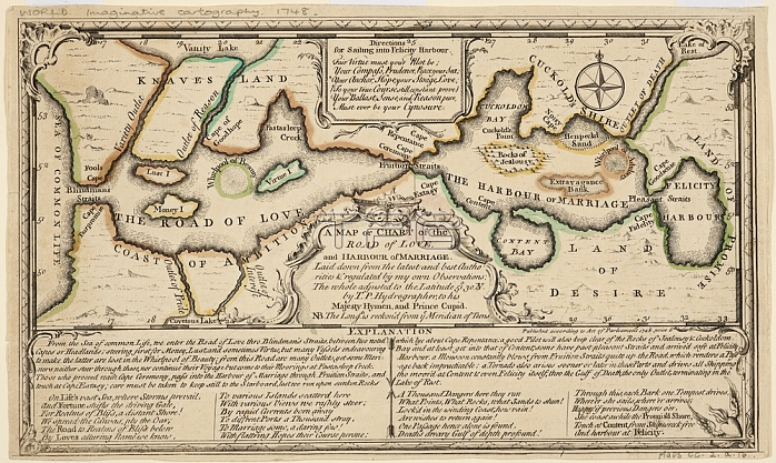
A map or chart of the road of love; and harbour of marriage. by T. P. Hydrographer; to his Majesty Hymen; and Prince Cupid. With Explanation. ; Published between 1725-1794; 1 map: hand col ; 12 x 28cm. on sheet 26 x 35cm.Fleet Street; London; England.From: A map or chart of the road of love; and harbour of marriage. by T. P. Hydrographer; to his Majesty Hymen; and Prince Cupid.Maps CC. 2. a. 16London; British Library.
| px | px | dpi | = | cm | x | cm | = | MB |
Details
Creative#:
TOP20991711
Source:
達志影像
Authorization Type:
RM
Release Information:
須由TPG 完整授權
Model Release:
No
Property Release:
No
Right to Privacy:
No
Same folder images:
Restriction:
Additional permissions needed for non-editorial use.
 Loading