
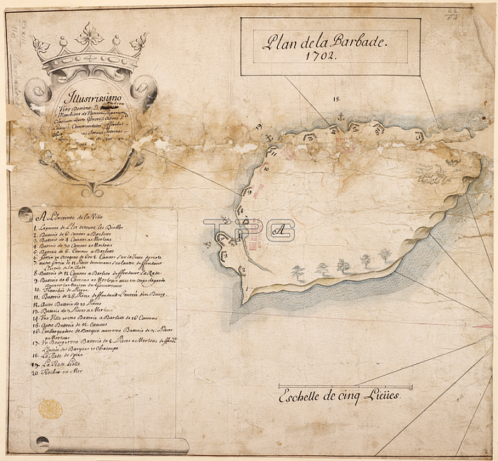
Platevet de Paor.Plan de la Barbade. A simple map of the island of Barbados in 1702. ; published in 1702 "Plan de la Barbade; 1702; " dedicated to Andre? Marquis de Nesmond; Admiral; by Jean. thov. Platevet de Paor; drawn on a scale of one inch to a league.France.From: Plan de la Barbade; 1702.Maps K. Top. 123.116London; British Library.
| px | px | dpi | = | cm | x | cm | = | MB |
Details
Creative#:
TOP20991696
Source:
達志影像
Authorization Type:
RM
Release Information:
須由TPG 完整授權
Model Release:
No
Property Release:
No
Right to Privacy:
No
Same folder images:
Restriction:
Additional permissions needed for non-editorial use.
 Loading