
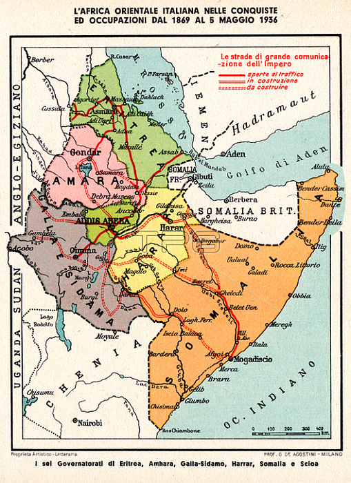
CARTOGRAPHY Italian Oriental Africa in Conquests and Occupations from 1869 to May 5; 1936. In Red: The Roads of Great Communication of the Empire Open to Traffic; under Construction or Construction in the Six Governatorates of Eritrea; Amhara; Galla-Sidamo; Harrar ; Somalia and Scioa. Historical cartography from the volume: "From the resurgence to the empire Historic Atlantis with textual text" by Giovanni De Agostini (August 23; 1863 - November 21; 1941); Italian geographer and cartographer and founder of the homonymous publishing house; and Giovanni Antonio Monti (1882 - 1953); Director of the Risorgimento Museum and teacher of the History of the Risorgimento at the University of Milan (see cover in # 39583). Italy; September 1938.
| px | px | dpi | = | cm | x | cm | = | MB |
Details
Creative#:
TOP20989831
Source:
達志影像
Authorization Type:
RM
Release Information:
須由TPG 完整授權
Model Release:
No
Property Release:
No
Right to Privacy:
No
Same folder images:
 Loading