
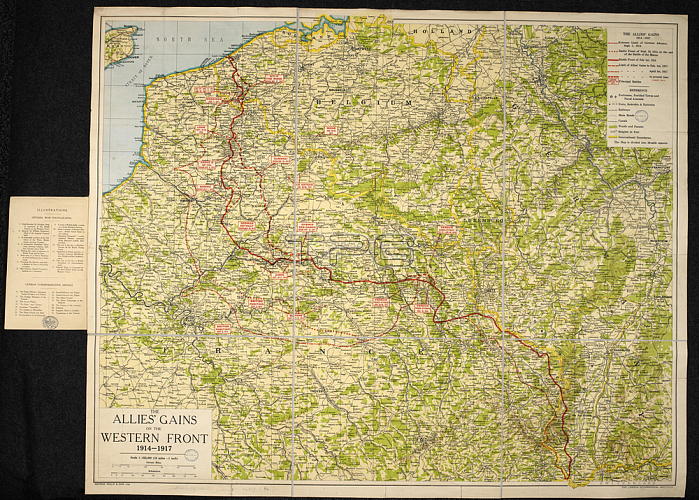
A map of the First World War: The Allies' gains on the Western Front; 1914-1917. 880 x 710 mm.; Scale 1: 633 000.London: G. Philip & Son; 1918.From: The Allies' gains on the Western Front; 1914-1917. Scale; 1: 633; 000; 10 miles = 1 inch. ([With] numerous-official photographs).Maps. 14317. (84)London; British Library.
| px | px | dpi | = | cm | x | cm | = | MB |
Details
Creative#:
TOP20986941
Source:
達志影像
Authorization Type:
RM
Release Information:
須由TPG 完整授權
Model Release:
No
Property Release:
No
Right to Privacy:
No
Same folder images:
Restriction:
Additional permissions needed for non-editorial use.
 Loading