
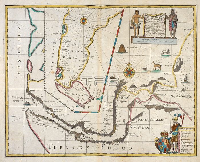
John Narbrough.A map of the Magellan straights; and an inset map of part of South America. With an inset map of the southern part of South America; from Valdivia southwards.London]; 1673.From: John Narbrough; A New Mapp of Magellans Straights. Discovered by Capt: John Narbrough (Com痑nder then of his Majesties ship the Sweepstakes) as he sayled through the sade Straights. Made and sold by John Thornton; Hydrographer at ye signe of England Scotland & Ireland in ye Minories; & by James Atkinson Mathematical Instrument maker on ye East side of S. Saveris Dock over against the Griffin; and at his shop at Cherry Garden Stairs.Maps * 88665. (9.)London; British Library.
| px | px | dpi | = | cm | x | cm | = | MB |
Details
Creative#:
TOP20986344
Source:
達志影像
Authorization Type:
RM
Release Information:
須由TPG 完整授權
Model Release:
No
Property Release:
No
Right to Privacy:
No
Same folder images:
Restriction:
Additional permissions needed for non-editorial use.
 Loading