
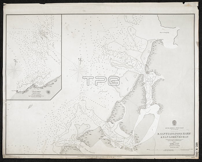
A chart of the River Santiago; Posa Harbour and San Lorenzo Bay.London; 1861.From: R[iver] Santiago; Posa Harbr and San Lorenzo Bay. Surveyed by Capt. H. Kellett and the officers of H.M.S. Herald; 1847. [Admiralty Chart].Maps SEC. 10. (2801.)London; British Library.
| px | px | dpi | = | cm | x | cm | = | MB |
Details
Creative#:
TOP20985540
Source:
達志影像
Authorization Type:
RM
Release Information:
須由TPG 完整授權
Model Release:
No
Property Release:
No
Right to Privacy:
No
Same folder images:
Restriction:
Additional permissions needed for non-editorial use.
 Loading