
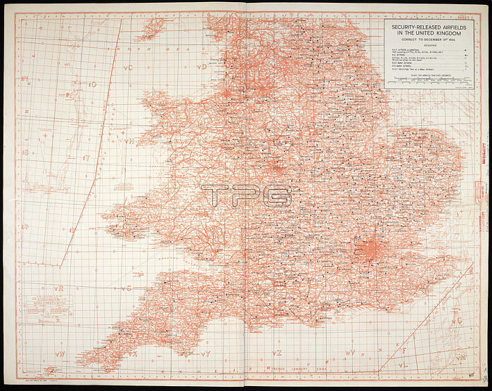
Map / chart of security Released Airfields in the United Kingdom; to 31st December 1944. col.; Scale 1: 633 600.[S. l.]: [s. n.]; 1944-1945.From: Security Released Airfields in the United Kingdom; GSGS Misc. 505.Maps MOD GSGS Misc. 505. Lower half of map.London; British Library.
| px | px | dpi | = | cm | x | cm | = | MB |
Details
Creative#:
TOP20985461
Source:
達志影像
Authorization Type:
RM
Release Information:
須由TPG 完整授權
Model Release:
No
Property Release:
No
Right to Privacy:
No
Same folder images:
Restriction:
Additional permissions needed for non-editorial use.
 Loading