
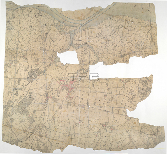
Anonymous.Faversham; Kent. 18th century map.This is a plan of the Kentish flatlands surrounding Faversham; to the south of The Swale. Ruled red-ink lines radiating from observation stations and intersecting across the map; indicate angular measurements taken by the surveyor between fixed triangulation points. The irregularly shaped paper is so worn and torn that much of the detail is now erased. Pen and ink on paperMap scale ratio: 6': Mile (1: 10560)Length: 35; Width: 33.1798.From: Anonymous.OSD 112 (pt2); 27BLondon; British Library.
| px | px | dpi | = | cm | x | cm | = | MB |
Details
Creative#:
TOP20985078
Source:
達志影像
Authorization Type:
RM
Release Information:
須由TPG 完整授權
Model Release:
No
Property Release:
No
Right to Privacy:
No
Same folder images:
Restriction:
Additional permissions needed for non-editorial use.
 Loading