
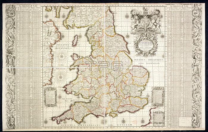
A map of England and Wales with an alphabetical table of all the cities and market towns in England and Wales.London: P. Lea; 1694.From: [Angliae totius tabula cum distantijs notioribus in Itinerantium usum accommodata. Johannes Adams. descripsit. An Alphabetical Table of all the Cities and Market Towns in England and Wales. [1684.] Serenissimo ac pototentissimo principi Dno. Carolo II. Dei gratia Magnae Britanniae Franciae et Hiberniae Regi. hanc Tabulam regiarum viarum indicem humillime consecrat Ioh. Adams. [Scale; 1 inch = about 20 miles. With the Arms of Charles II]].Maps 1205. (21.) London; British Library.
| px | px | dpi | = | cm | x | cm | = | MB |
Details
Creative#:
TOP20983253
Source:
達志影像
Authorization Type:
RM
Release Information:
須由TPG 完整授權
Model Release:
No
Property Release:
No
Right to Privacy:
No
Same folder images:
Restriction:
Additional permissions needed for non-editorial use.
 Loading