
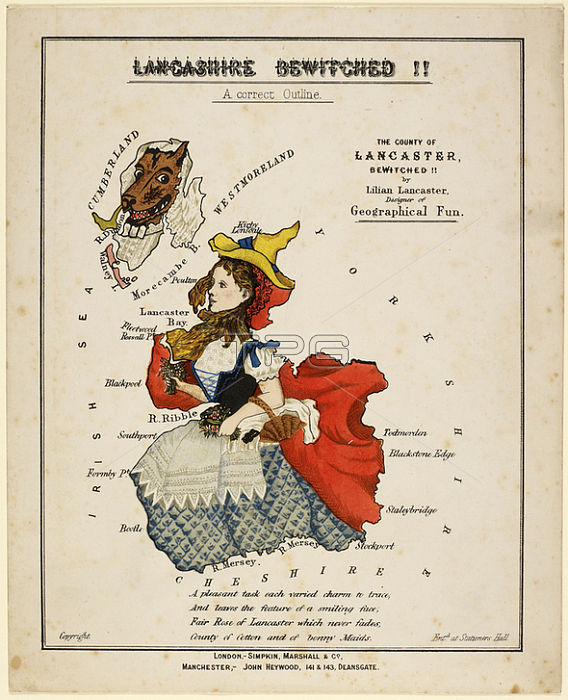
Lancashire Betwitched! An outline of the county as Red Riding Hood and the wolf. ; Published by Simpkin; Marshall & Co and John Heywood; [18--]. Map of Lancashire represented as Red Riding Hood and the wolf. Produced after the publication of "Geographical fun" in 1869. Drawn by Lilian Lancaster; who produced later works under her married name; Tennant.London; Manchester.From: Lilian Lancaster; Lancashire bewitched !! a correct outline: The county of Lancashire bewitched / by Lilian Lancaster; designer of Geographical fun.Maps cc. 5. a. 224London; British Library.
| px | px | dpi | = | cm | x | cm | = | MB |
Details
Creative#:
TOP20982685
Source:
達志影像
Authorization Type:
RM
Release Information:
須由TPG 完整授權
Model Release:
No
Property Release:
No
Right to Privacy:
No
Same folder images:
Restriction:
Additional permissions needed for non-editorial use.
 Loading