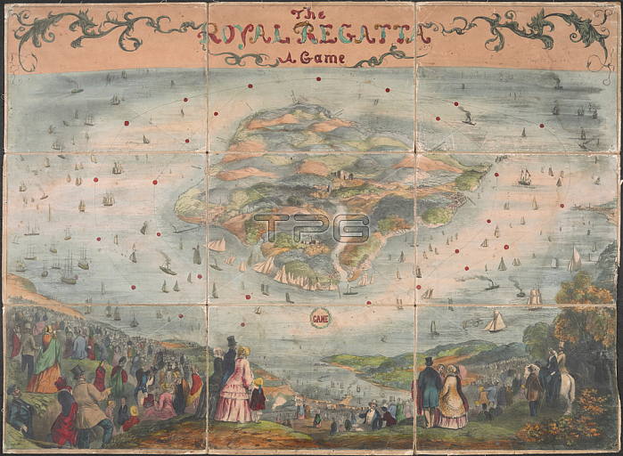
Geographical game reinacting a yacht race. Produced to commemorate the Royal Yacht Squadron's 100 Guinea Cup of August 1851; in which players use counters and dice with the map to race each other around the Isle of Wight. Perspective view of the Isle of Wight and Solent from the north; seen from an imaginary hill. On the Solent can be identified the British naval fleet and the royal yacht Victoria and Albert (constructed 1855). A fashionably dressed crowd observe the race from the surrounding landscape. Hand coloured aquatint engraving. Dissected into 9 panels and mounted on linen. 1 map: hand col. ; 53 x 73 cm.London: David Ogilvy; c. 1852.From: The Royal Regatta: a game.Maps. cc. 5. a. 575London; British Library.
| px | px | dpi | = | cm | x | cm | = | MB |
Details
Creative#:
TOP20981526
Source:
達志影像
Authorization Type:
RM
Release Information:
須由TPG 完整授權
Model Release:
No
Property Release:
No
Right to Privacy:
No
Same folder images:
Restriction:
Additional permissions needed for non-editorial use.

 Loading