
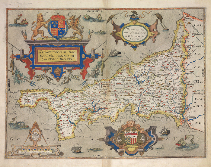
Christopher Saxton.Cornwall; Map of Cornwall.Image taken from Promontorium hoc Cornubia dicitur 1576. C. Saxton descripsit. L. Terwoort Antverpianus sculpsit. In: C. Saxton's Atlas of England and Wales.Originally published: 1579.London; 1579.From: Promontorium hoc. Cornubia dicitur. 1576. C.Maps. C. 7. c. 1; 5London; British Library.
| px | px | dpi | = | cm | x | cm | = | MB |
Details
Creative#:
TOP20534019
Source:
達志影像
Authorization Type:
RM
Release Information:
須由TPG 完整授權
Model Release:
No
Property Release:
No
Right to Privacy:
No
Same folder images:
Restriction:
Additional permissions needed for non-editorial use.
 Loading