
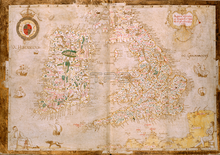
Laurence Nowell.Map of Great Britain and Ireland; [Whole map] Map of England and Ireland; extending from Arbroath in Scotland to the Franco-Flemish coast. From a geographical commonplace book of William Cecil; Lord Burghley; with his annotations. In lower corners; a reclining figure [Nowell?] with dog; and Cecil seated on an hour glassImage taken from Nowell-Burghley Atlas.Originally published / produced in circa 1564.circa 1564.From: Nowell-Burghley Atlas.Add. 62540; ff. 3v-4London; British Library.
| px | px | dpi | = | cm | x | cm | = | MB |
Details
Creative#:
TOP20533650
Source:
達志影像
Authorization Type:
RM
Release Information:
須由TPG 完整授權
Model Release:
No
Property Release:
No
Right to Privacy:
No
Same folder images:
Restriction:
Additional permissions needed for non-editorial use.
 Loading