
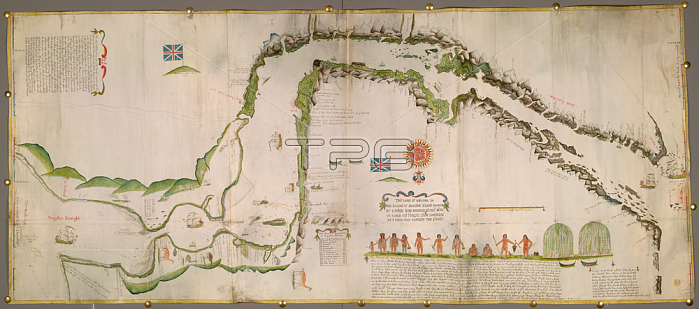
Straits of Magellan; Pictorial map of the Straits of Magellan.Image taken from The Land of Patagona; etc. The draught of Magellan Straits; drawen by Captain John Narbrough; anno 1670; on board His Majesti's Shipp Sweepstaks; as I pased and repased the Straits; being a large colored chart; drawn on vellum; on a scale of 4 miles to an inch.Originally published / produced in 1670.1670.From: The Land of Patagona; etc. The draught of Magellan.Maps K. Top. 124.84.8 TAB.ENDLondon; British Library.
| px | px | dpi | = | cm | x | cm | = | MB |
Details
Creative#:
TOP20533265
Source:
達志影像
Authorization Type:
RM
Release Information:
須由TPG 完整授權
Model Release:
No
Property Release:
No
Right to Privacy:
No
Same folder images:
Restriction:
Additional permissions needed for non-editorial use.
 Loading