
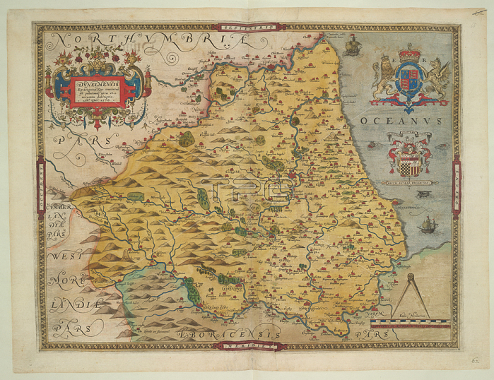
Christopher Saxton.Map of County Durham.This map is actually a proof copy of one which forms part of Christopher Saxton's Atlas of England and Wales.41 x 54.3 cm.1576.From: DUNELMIENSIS Episcopatus. Part of an atlas that belonged to William Cecil Lord Burghley.Royal 18 D. III; f. 68London; British Library.
| px | px | dpi | = | cm | x | cm | = | MB |
Details
Creative#:
TOP20532489
Source:
達志影像
Authorization Type:
RM
Release Information:
須由TPG 完整授權
Model Release:
No
Property Release:
No
Right to Privacy:
No
Same folder images:
Restriction:
Additional permissions needed for non-editorial use.
 Loading