
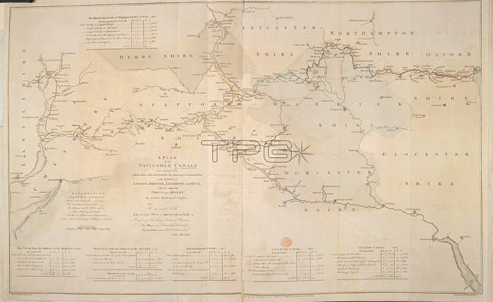
Navigable canals; A Plan of the Navigable Canals now making in the Inland.[London]; 1769.From: J Brindley; A Plan of the Navigable Canals now making in the Inland Parts of this Kingdom; for opening a communicaiton to the Ports of London; Bristol; Liverpool & Hull; with the adjacent Towns and Rivers. By J. Brindley.Maps. K. Top. 6.28. aLondon; British Library.
| px | px | dpi | = | cm | x | cm | = | MB |
Details
Creative#:
TOP20528334
Source:
達志影像
Authorization Type:
RM
Release Information:
須由TPG 完整授權
Model Release:
No
Property Release:
No
Right to Privacy:
No
Same folder images:
Restriction:
Additional permissions needed for non-editorial use.
 Loading