
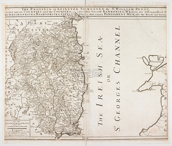
A map of the province of Leinster.London: George Wildey; [1730?].From: The Province of Leinster Surveyed by Sr William Petty. Divided into its Counties and the Counties into their severall Barronies. Irish miles; 20[ = 80 mm]].Maps * 10945. (5.) London; British Library.
| px | px | dpi | = | cm | x | cm | = | MB |
Details
Creative#:
TOP20502743
Source:
達志影像
Authorization Type:
RM
Release Information:
須由TPG 完整授權
Model Release:
No
Property Release:
No
Right to Privacy:
No
Same folder images:
Restriction:
Additional permissions needed for non-editorial use.
 Loading