
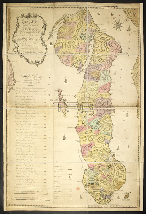
A map of the district of Kantyre (Kintyre) in Argyllshire.1793.From: A Map of the District of Kantyre. By George Langlands & Son. Bell and Crichton sculp. A scale of eight British statute miles[ = 197 mm].Maps * 7720. (2.) London; British Library.
| px | px | dpi | = | cm | x | cm | = | MB |
Details
Creative#:
TOP20502657
Source:
達志影像
Authorization Type:
RM
Release Information:
須由TPG 完整授權
Model Release:
No
Property Release:
No
Right to Privacy:
No
Same folder images:
Restriction:
Additional permissions needed for non-editorial use.
 Loading