
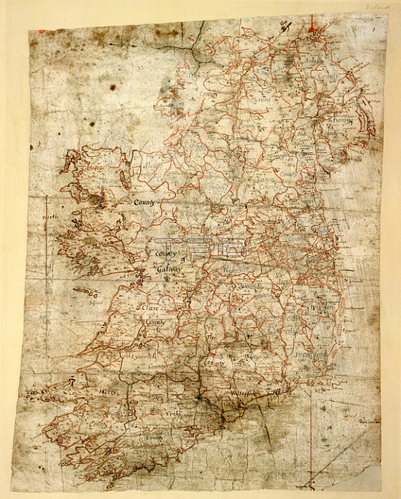
Map of Ireland; {Whole map]. Map of Ireland; produced for Sir William Petty's Hiberniae Delineatio; published in 1684; the first printed atlas of Ireland.Image taken from the Petty Papers; Vol. XVI.Originally produced in Ireland [Dublin] between 1656 and 1665.Ireland [Dublin]; between 1655 and 1665.From: Petty Papers; Vol. XVI.Add. 72875 ALondon; British Library.
| px | px | dpi | = | cm | x | cm | = | MB |
Details
Creative#:
TOP20500157
Source:
達志影像
Authorization Type:
RM
Release Information:
須由TPG 完整授權
Model Release:
No
Property Release:
No
Right to Privacy:
No
Same folder images:
Restriction:
Additional permissions needed for non-editorial use.
 Loading