
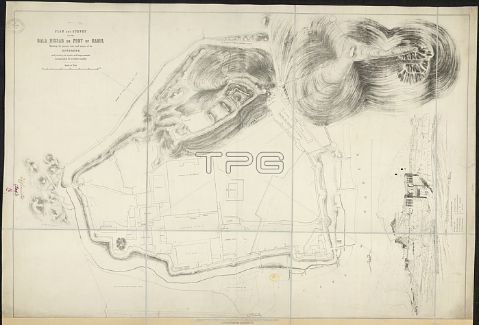
Bala Hissar; Plan and Survey of the Bala Hissar or Fort of Cabul.Image taken from Plan and Survey of the Bala Hissar or Fort of Cabul; shewing the present state and nature of its Defences; and pointing out repairs and improvements recommended for its better security. Lithographed from a copy 1839. Scale of feet; 500[= 100 mm].Originally published / produced in Calcutta: Surveyor General's Office; 1878.Calcutta: Surveyor General's Office; 1878.From: Plan and Survey of the Bala Hissar or Fort of Cabu.Maps. 52000. (9); London; British Library.
| px | px | dpi | = | cm | x | cm | = | MB |
Details
Creative#:
TOP20499912
Source:
達志影像
Authorization Type:
RM
Release Information:
須由TPG 完整授權
Model Release:
No
Property Release:
No
Right to Privacy:
No
Same folder images:
Restriction:
Additional permissions needed for non-editorial use.
 Loading