
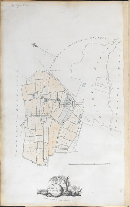
Thornton Grange; A Plan of Lands called Thornton Grange in the County of Chester.Image taken from A Plan of Lands called Thornton Grange in the County of Chester [and parish of Neston]; 1788. Drawn in 1792 by Tho. Bainbridge. 30 chains[ = 95 mm.] [With terrier and notes].Originally published / produced in 1792.1792.From: A Plan of Lands called Thornton Grange in the Coun.C. 7. e. 17; 12London; British Library.
| px | px | dpi | = | cm | x | cm | = | MB |
Details
Creative#:
TOP20499239
Source:
達志影像
Authorization Type:
RM
Release Information:
須由TPG 完整授權
Model Release:
No
Property Release:
No
Right to Privacy:
No
Same folder images:
Restriction:
Additional permissions needed for non-editorial use.
 Loading