
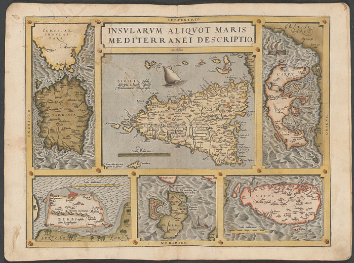
Mediterranean islands; Maps of Corsica; Sardinia; Sicily; Corfu; Elba and Malta.Image taken from The Mercator atlas of Europe.Originally published / produced in 1570-1572.1570-1572.From: The Mercator atlas of Europe.Maps. C. 29. c. 13; 21London; British Library.
| px | px | dpi | = | cm | x | cm | = | MB |
Details
Creative#:
TOP20499169
Source:
達志影像
Authorization Type:
RM
Release Information:
須由TPG 完整授權
Model Release:
No
Property Release:
No
Right to Privacy:
No
Same folder images:
Restriction:
Additional permissions needed for non-editorial use.
 Loading