
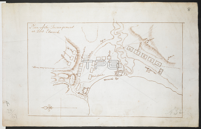
鈥楶lan of the incampement of Fort Edward'; possibly by Thomas Sowers.Map oriented with East at top. Ink on paper. 160 x 260mm. No scale given.18th century. circa 1759.From: R.U.S.I. MAPS. Vol. LXXVI (1-13). 57711 (1-4). Places in states North-East of New York.Add. 57711.8 Amherst no. A 32. R.U.S.I. no. A 28.67. London; British Library.
| px | px | dpi | = | cm | x | cm | = | MB |
Details
Creative#:
TOP20498583
Source:
達志影像
Authorization Type:
RM
Release Information:
須由TPG 完整授權
Model Release:
No
Property Release:
No
Right to Privacy:
No
Same folder images:
Restriction:
Additional permissions needed for non-editorial use.
 Loading