
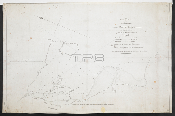
鈥楢 plan of the harbour of Mahwinnee; Nootka Sound; by Capt. Broughton of MS Providence 1796'. Ink on paper. 380 x 560mm.1: 3200. 鈥楽cale of 200 fathoms' (= 4.5 inches). Map oriented with East-North-East at top.18th century.From: R.U.S.I. MAPS. Vol. LXXIII (1-13).Add. 57708 f. 15 R.U.S.I. no. A 28.16.London; British Library.
| px | px | dpi | = | cm | x | cm | = | MB |
Details
Creative#:
TOP20498576
Source:
達志影像
Authorization Type:
RM
Release Information:
須由TPG 完整授權
Model Release:
No
Property Release:
No
Right to Privacy:
No
Same folder images:
Restriction:
Additional permissions needed for non-editorial use.
 Loading