
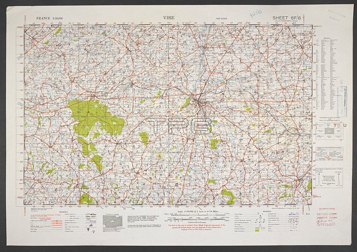
A map produced during the Second World War; showing Vire; in the Basse-Normandie region; northwestern France.War Office. General staff. Geographical section. [London]: Ordnance Survey; 1942.From: France 1: 50; 000.Maps MOD GSGS 4250. Sheet 6F/6. Superceded copy.London; British Library.
| px | px | dpi | = | cm | x | cm | = | MB |
Details
Creative#:
TOP20497576
Source:
達志影像
Authorization Type:
RM
Release Information:
須由TPG 完整授權
Model Release:
No
Property Release:
No
Right to Privacy:
No
Same folder images:
Restriction:
Additional permissions needed for non-editorial use.
 Loading