
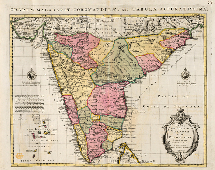
Malabar and Coromondel; Map of the coast of Malabar and Coromondel. South west coast of India.Image taken from Carte des c魌es de Malabar et de Coromandel; par G. de l'Isle.Originally published / produced in Amsterdam: Covens et Mortier; 1730.Amsterdam: Covens et Mortier; 1730.From: Carte des c魌es de Malabar et de Coromandel; par G.Maps. K. Top. 115.63; 31London; British Library.
| px | px | dpi | = | cm | x | cm | = | MB |
Details
Creative#:
TOP20497307
Source:
達志影像
Authorization Type:
RM
Release Information:
須由TPG 完整授權
Model Release:
No
Property Release:
No
Right to Privacy:
No
Same folder images:
Restriction:
Additional permissions needed for non-editorial use.
 Loading