
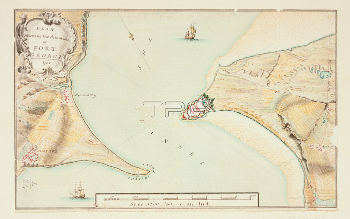
Plan of Fort George; A plan showing the situation of Fort George.Image taken from A colored survey of the points of Arderseer and Channary; in the Murray Firth; shewing the situation of Fort George; and the soundings of the channel; designed by Wm. Skinner; Director of his Majesty's Engineers; in 1752; and drawn by Charles Tarrant; on a scale of 400 feet to an inch.Originally published / produced in 1752.1752.From: A colored survey of the points of Arderseer and Ch.Maps. K. Top. 50.24; London; British Library.
| px | px | dpi | = | cm | x | cm | = | MB |
Details
Creative#:
TOP20497159
Source:
達志影像
Authorization Type:
RM
Release Information:
須由TPG 完整授權
Model Release:
No
Property Release:
No
Right to Privacy:
No
Same folder images:
Restriction:
Additional permissions needed for non-editorial use.
 Loading