
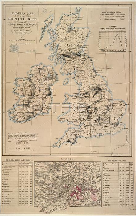
Cholera map of the British Isles.London: J. Betts; [1852?].From: Cholera Map of the British Isles shewing the distr.Maps. 1101. (1); London; British Library.
| px | px | dpi | = | cm | x | cm | = | MB |
Details
Creative#:
TOP20496861
Source:
達志影像
Authorization Type:
RM
Release Information:
須由TPG 完整授權
Model Release:
No
Property Release:
No
Right to Privacy:
No
Same folder images:
Restriction:
Additional permissions needed for non-editorial use.
 Loading