
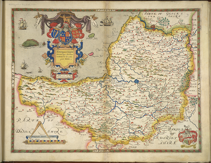
Somerset; A map of Somerset.Image taken from An atlas of England and Wales; containing 35 coloured maps; drawn by Christopher Saxton and engraved by A. Ryther; R. Hogenberg; C. Hogius; N. Reynolds; L. Terwoort and F. Scatter.Originally published / produced in 1579.London; 1579.From: An atlas of England and Wales; containing 35 colou.Maps. C. 3. bb. 5; 9London; British Library.
| px | px | dpi | = | cm | x | cm | = | MB |
Details
Creative#:
TOP20495607
Source:
達志影像
Authorization Type:
RM
Release Information:
須由TPG 完整授權
Model Release:
No
Property Release:
No
Right to Privacy:
No
Same folder images:
Restriction:
Additional permissions needed for non-editorial use.
 Loading